Region L: South Central Texas
Texas is divided into 16 water planning regions. The 16 regions were created by looking at shared water sources, community boundaries, public input, and other factors. Here we highlight Region L in South Central Texas. Anchored by San Antonio, this fast-growing region relies upon a variety of groundwater and surface water sources to support expanding cities, agriculture, and industry.
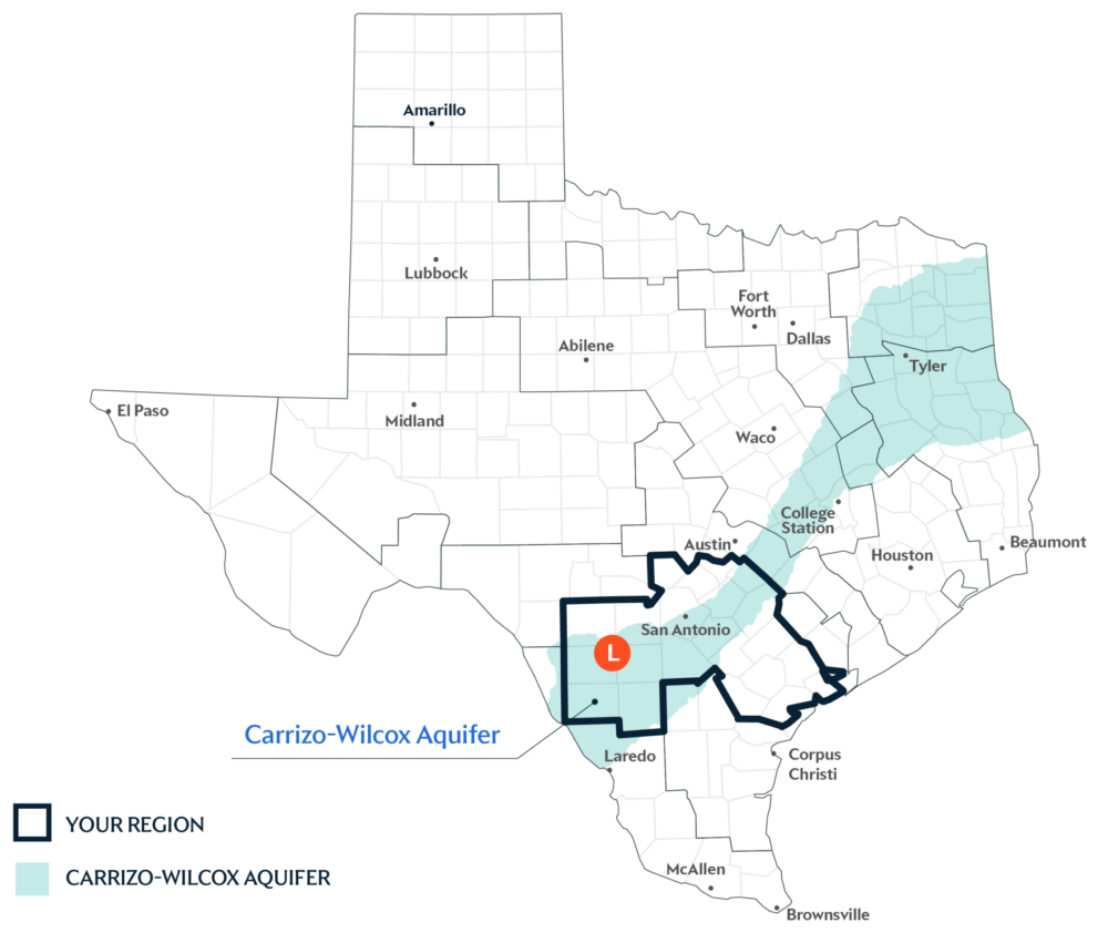
Primary Water Source: Carrizo-Wilcox Aquifer
Most of this region’s water comes from groundwater sources like the Carrizo-Wilcox Aquifer. An aquifer is like a sponge underground that holds water from rain and rivers after it soaks into the ground. The Carrizo-Wilcox Aquifer provides nearly half of the region’s groundwater supplies.
Key issues and approaches for Region L
Population growth, irrigation demand, and aquifers dependent on rain for recharge remain considerations in shaping water planning for South Central Texas. The regional water plan—updated every five years and projected through 2080—includes approaches like drought management, groundwater well expansion, and municipal conservation to help meet future water needs.
Dive deeper into the Interactive 2027 State Water Plan and learn more about Region L.