
Region E: Far West Texas
Texas is divided into 16 water planning regions. The 16 regions were created by looking at shared water sources, community boundaries, public input, and other factors. Here we highlight Region E in Far West Texas. Part of the Chihuahuan Desert and spanning the Rio Grande Basin, this region’s population draws most of its water from aquifers while working binationally to manage one of our state’s most vital river systems.
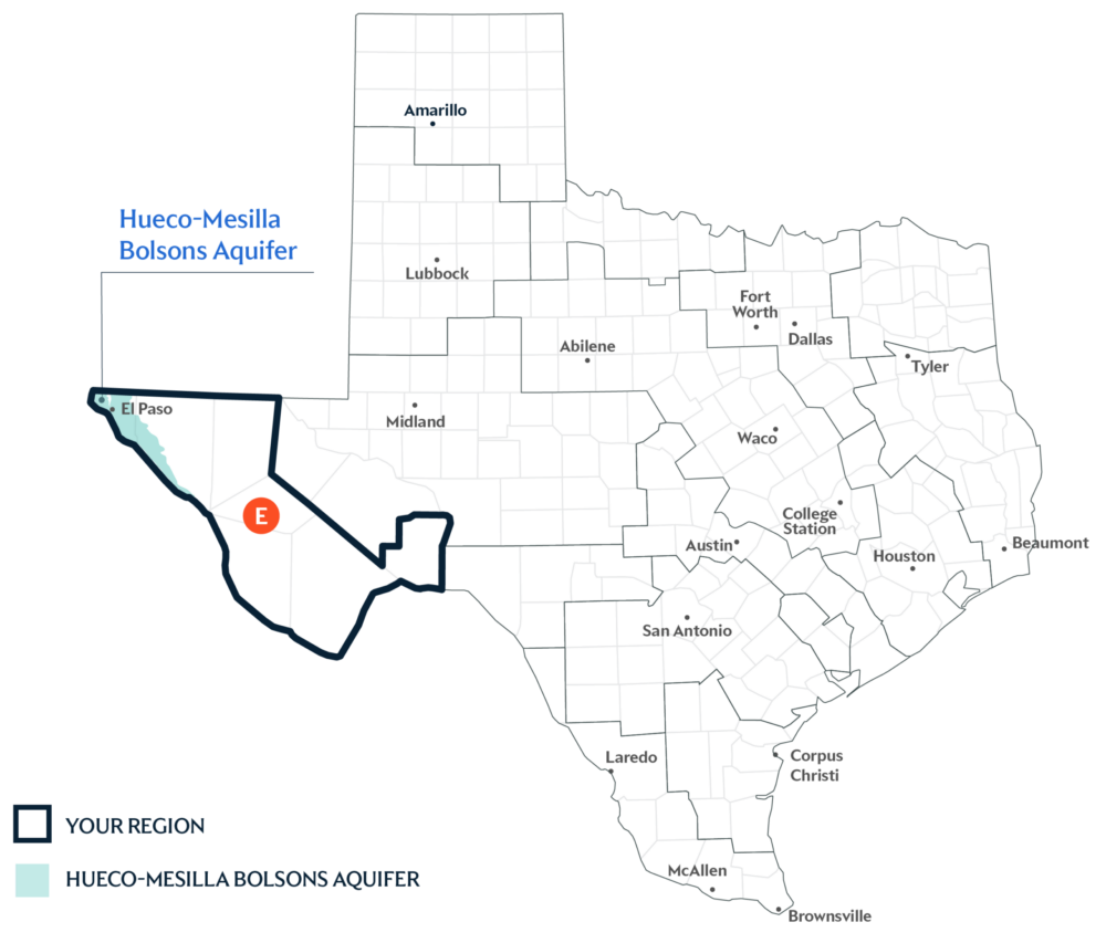
A Primary Water Source: Hueco-Mesilla Bolsons Aquifer
An aquifer is like a sponge underground that holds water from rain and rivers after it soaks into the ground. The Hueco-Mesilla Bolsons Aquifer in West Texas is recognized as a major aquifer in Texas. It supplies water to El Paso and extends under the Rio Grande into Mexico.
Key issues and approaches for Region E
Extreme drought conditions and shared water obligations to bordering states and Mexico, along with groundwater decline, continue to challenge long-term water reliability in Far West Texas. The regional water plan—updated every five years and projected through 2080—highlights agricultural and municipal conservation, groundwater well expansion, and direct potable reuse to improve long-term reliability.
Dive deeper into the Interactive 2027 State Water Plan and learn more about Region E. If you have any questions about your Region’s information please email [email protected].