Region A: Panhandle
Texas is divided into 16 water planning regions. The 16 regions were created by looking at shared water sources, community boundaries, public input, and other factors. Here we highlight Region A in the Panhandle. Part of the High Plains, this region draws much of its water from the Ogallala Aquifer and relies on water to support crop production and agriculture—key drivers of the region’s economy.
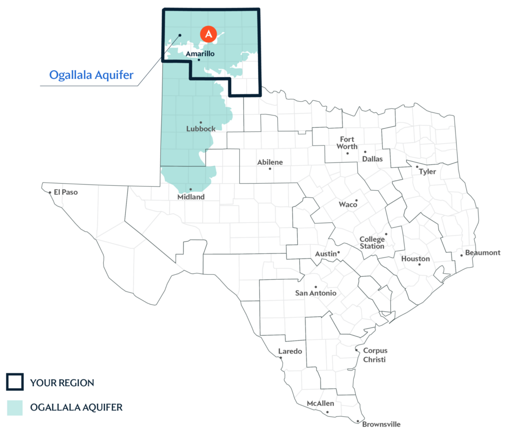
Primary Water Source: Ogallalla Aquifer
An aquifer is like a sponge underground that holds water from rain and rivers after it soaks into the ground. The Ogallala Aquifer in the Panhandle is the largest aquifer in the U.S. and provides significantly more water to Texans than any other aquifer in the state.
Key issues and approaches for Region A
Long-term drought, declining aquifer levels, and limited surface water supplies continue to impact water reliability across the Panhandle. The Region A water plan—updated every five years and projected through 2080—highlights agricultural and municipal conservation, along with groundwater well expansion to help meet future water needs.
Dive deeper into the Interactive 2027 Draft State Water Plan and learn more about Region A.