Region D: Northeast Texas
Texas is divided into 16 water planning regions. The 16 regions were created by looking at shared water sources, community boundaries, public input, and other factors. Here we highlight Region D in Northeast Texas. Defined by its forests, row crops, and agriculture, this region relies on large reservoirs across multiple basins that include the Sabine, Red, and Sulphur rivers as well as Cypress Creek.
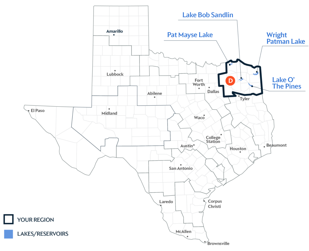
Primary Water Source: Multiple Lakes
This region is known for its abundant surface water resources, which is where the region gets most of its supply. And the largest sources are reservoirs—including Lake O’ the Pines, Pat Mayse Lake, Wright Patman Lake, and Lake Bob Sandlin.
Key issues and approaches for Region D
Water quality and heavy reliance on surface water reservoirs continue to shape planning priorities in northeast Texas. The regional water plan—updated every five years and projected through 2080—includes municipal conservation efforts, groundwater well expansion, and additional surface water development to improve long-term reliability.
Dive deeper into the Interactive 2027 Draft State Water Plan and learn more about Region D.