Region P: Lavaca
Texas is divided into 16 water planning regions. The 16 regions were created by looking at shared water sources, community boundaries, public input, and other factors. Here we highlight Region P in the coastal plains of southeastern Texas. It’s named after the Lavaca River that runs through the region, yet most of the water in Region P comes from groundwater pumped from the Gulf Coast Aquifer System.
Some counties within this region may be in multiple planning areas. County-to-region assignments reflect each county’s primary designation as established by the Texas Water Development Board.
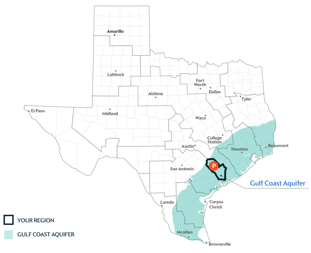
Primary Water Source: Gulf Coast Aquifer System
The Gulf Coast Aquifer System consists of several aquifers that run parallel to the coastline from Louisiana to the Mexico border. This aquifer system serves about 85 percent of the total supply in the region.
Dive deeper into the Interactive 2027 Draft State Water Plan and learn more about Region P.
Key issues and approaches for Region P
Groundwater dependence, irrigation demand, and considerations for local supply alternatives continue to shape long-term water planning in the Lavaca area. The regional water plan—updated every five years and projected through 2080—includes agricultural and industrial conservation and additional surface water development to help improve reliability.