Region G: Brazos River Basin
Texas is divided into 16 water planning regions. The 16 regions were created by looking at shared water sources, community boundaries, public input, and other factors. Here we highlight Region G. Stretching from the rolling plains near Abilene to the I-35 corridor bordering Waco into the lower Brazos River Basin, this region’s long-established river and reservoir systems support fast-growing urban counties, major universities and industry, and extensive agriculture.
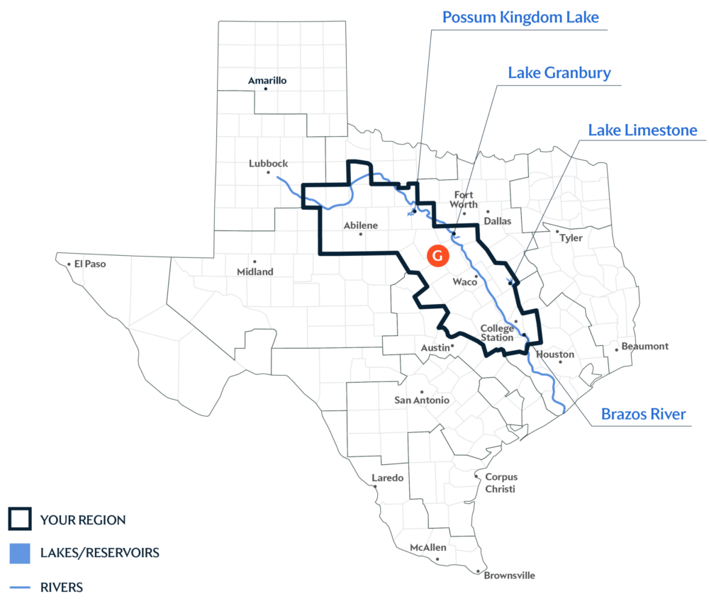
Primary Water Source: Brazos River
More than 90 percent of this region lies within the Brazos River Basin, making the Brazos River the region’s primary water source. The river also feeds many other surface water sources in the region, including Possum Kingdom Lake, Lake Granbury, and Lake Limestone.
Key issues and approaches for Region G
Rapid population growth, changing reservoir conditions, and a range of agricultural, industrial, and municipal demands continue to shape local water planning. The regional water plan—updated every five years and projected through 2080—highlights new surface water supplies, groundwater well expansion, and municipal conservation as some of the approaches to help meet future water needs.
Dive deeper into the Interactive 2027 State Water Plan and learn more about Region G.