Region F: West Texas
Texas is divided into 16 water planning regions. The 16 regions were created by looking at shared water sources, community boundaries, public input, and other factors. Here we highlight Region F in arid West Texas. Anchored by Midland, Odessa, and San Angelo, this region’s water demand and economy are shaped by oil and gas production in the Permian Basin, irrigated agriculture, and ranching.
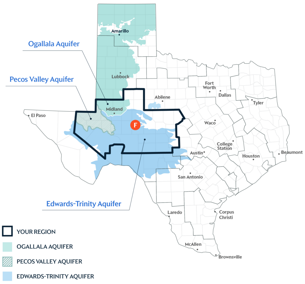
Primary Water Source: Multiple Aquifers
An aquifer is like a sponge underground that holds water from rain and rivers after it soaks into the ground. Region F gets more than 80 percent of its water supply from these vital groundwater sources. Its major aquifers include the Edwards-Trinity Plateau, Pecos Valley, and Ogallala aquifers.
Key issues and approaches for Region F
Increased demand on groundwater supplies, mining and irrigation demands, water quality considerations, and reservoir management continue to shape regional planning. The regional water plan—updated every five years and projected through 2080—includes agricultural conservation, developing additional surface water resources, and wastewater recycling to strengthen future supplies.
Dive deeper into the Interactive 2027 State Water Plan and learn more about Region F.